GPR is nowadays regarded as a standard method for road maintenance work in most areas of the world. It is an excellent tool for investigation of the entire road body, including asphalt thickness, a.k.a. surface course. Most modern equipment used for this application is light-weight and can be easily mounted on a vehicle and/or carried out by foot or hand if needed. The flexibility of the GPR method is a major benefit and another advantage is that it is a very fast. Multiple data points per meter can be carried out even at high traffic speeds.
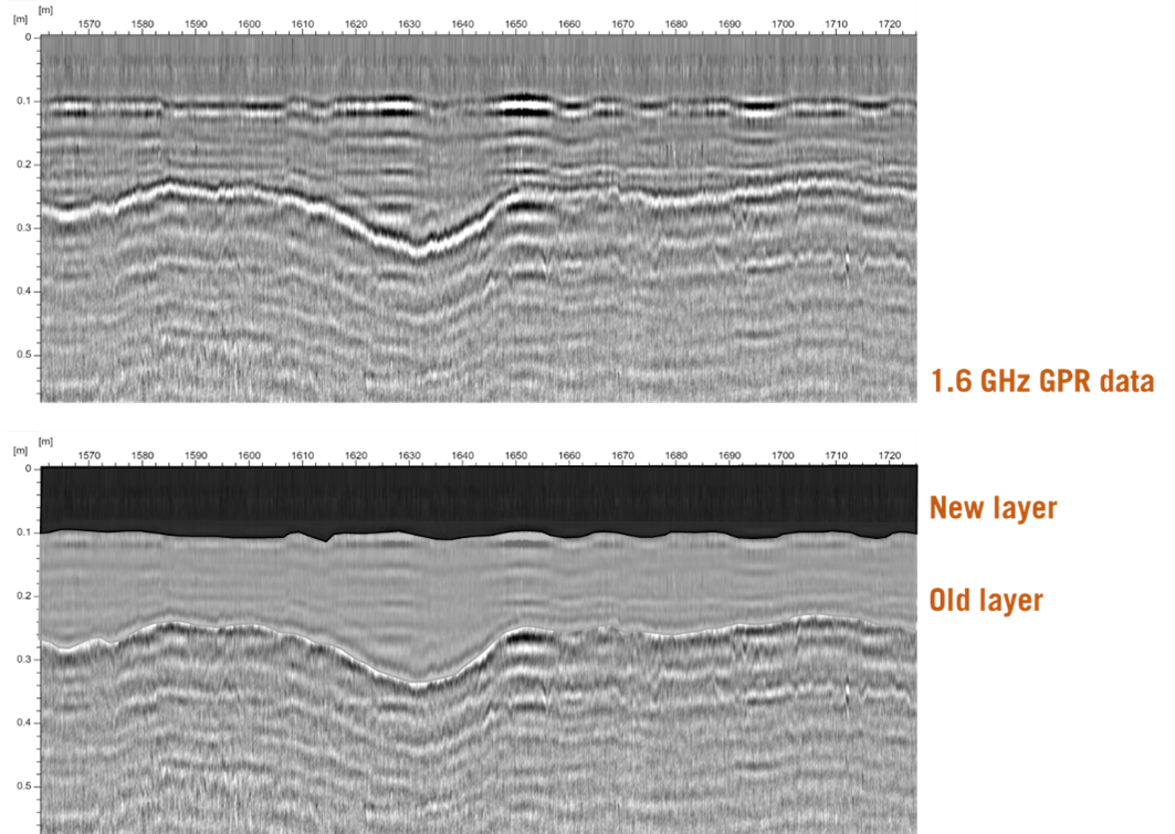
GPR investigations for asphalt thickness are normally carried out with high frequency antennas, such as 1.2, 1.6 or 2.3 GHz. The high frequency is needed to be able to resolve thin layers of asphalt. An asphalt layer can be as thin as a few centimeters, up to 30-50 cm, depending on road type and age. As a road is ageing and/or worn down, new asphalt is normally applied. An older road often contains multiple layers of asphalt added at different occasions. GPR can often successfully resolve each iteration of applied asphalt.
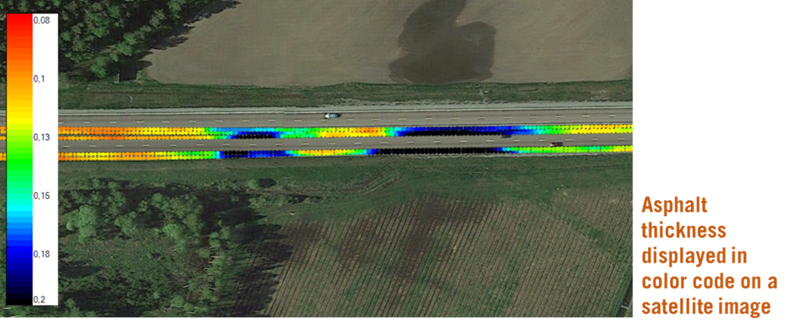
Asphalt investigations are important both from a maintenance view (to know where and when new asphalt is needed), but also as verification and quality control measure for work done. Both the entrepreneur doing the actual work with adding the asphalt and his client needs to know the work has been done well and followed the agreed workplan.
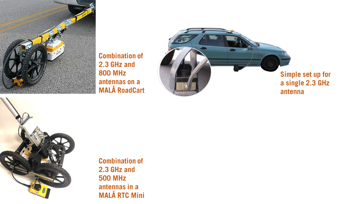
If the application is only to measure asphalt thickness, the GPR system can be quite small and easily applied on a standard vehicle without using a trailer. In many cases, the need is more than just looking through the asphalt but to investigate the complete road body and/or sometimes even below. In the latter case, multi-channel measurements combining several different antenna frequencies are used. Multi-channel measurements combines high and low antenna frequencies, whereas all the needed data in collected in one pass.
Most often investigations on roads are carried out in several lines to cover all lanes of the road. It is recommended to use a GNSS for precise positioning. To keep track of the collected data, data is normally viewed in real time using a laptop or other data collection unit. The measurements can in most cases easily be done by one person.
Note, in cold regions, where winter roads are treated with salt/salt-slurry, this will normally affect the GPR measurements negatively. The radar wave is then attenuated, and less information is gained from a survey.
Below some examples of instrument set up is shown, as well as data examples.
More to read
Application Areas
https://www.guidelinegeo.com/application-areas/
GPR
https://www.guidelinegeo.com/ground-penetrating-radar-gpr/
Case Stories
https://www.guidelinegeo.com/solutions/case-stories/
GPR Products
https://www.guidelinegeo.com/mala-ground-penetrating-radar-gpr/