Investigating Asphalt Conditions
There are more than 64 million kilometres of roads in the world, all of various ages and conditions. Around 65 % of roads are paved with asphalt, which is typically a mixture of stone aggregate and bituminous binders. The asphalt surface is the part of the road most exposed, and thus in need of constant maintenance.
To plan maintenance, knowledge is needed of the thickness of the asphalt layer as well as of other other roadlayers. The thickness of the asphalt is also critical during construction: has the contractor carried out the paving according to plan, or has less asphalt been used to save money?
To check the thickness of the asphalt, pointwise sampling or drilling are the most common investigation techniques today. To obtain more data and a better overview of the whole road surface, geophysical methods can instead be used as a suitable solution to create a more comprehensive picture of the asphalt structure.
Using GPR for Asphalt Investigations
Ground Penetrating Radar (GPR) is a non-destructive investigation method offered by Guideline Geo that can collect dense data points at highway speeds and map the total thickness of the asphalt as well as internal layering or voids. As the method is quick, it is also cost-efficient.
Asphalt investigations are most often quite shallow and need to be able to resolve thin layers. Antenna frequencies around 1.2 to 2.3 GHz are commonly used. In some cases, frequencies of 800 or 750 MHz are needed to detect a thicker asphalt pavement.

It should be remembered that depth penetration is highly dependent on the conductivity of the asphalt. Dry asphalt is generally well suited for investigation, whereas recently salted or salt-sprayed road surfaces are not recommended. Conductive salt slush will efficiently prevent radar waves from penetrating the asphalt.

GPR Measurements in 2D or 3D
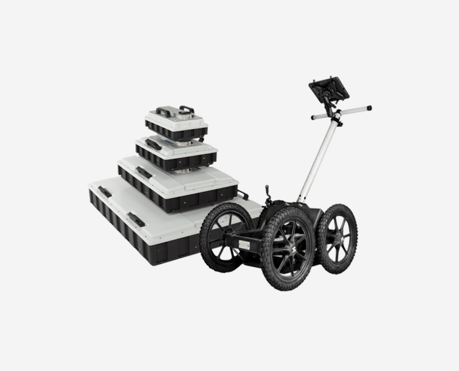
GPR measurements for asphalt applications are most often done in 2D, by moving the antennas along the ground (by pulling or pushing). This can be done by foot for smaller areas. For longer investigation lines, Guideline Geo also provides a convenient cart for holding 1-3 antennas behind a vehicle: the RoadCart. In this setup, a lower-frequency antenna can also be used to investigate deeper layers and features within or beneath the road construction. When measuring with the RoadCart the data collection unit can be placed in the front seat for easy check of the data collection.

Some asphalt applications (e.g. voids and delamination) require 3D measurements for a better understanding of the asphalt’s condition. This can be carried out by using dense 2D profiles, or with a multichannel 3D array solution such as MALÅ MIRA Compact or MALÅ MIRA HDR.
During measurements, the position of the GPR antenna is tracked by an external or internal GPS for precise positioning of your investigation results.
Also check out the application areas: Concrete Constructions and Rebars and Roads to learn about solutions for associated infrastructure such as road embankments, bridges, revetments, bridge decks etc.
Ground Penetrating Radar Investigation Results for Asphalt
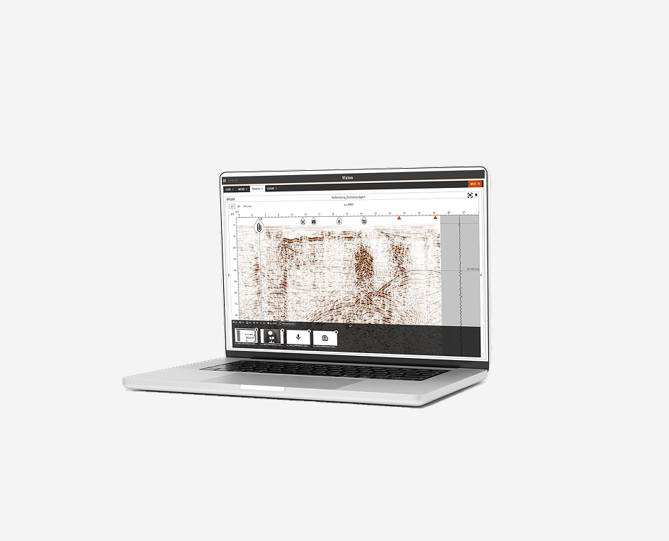
Results from a 2D GPR investigation of roads are generally straightforward. Data can be analysed in various post-processing software, where the data is processed and interpreted according to the application. Layer data is most often presented as X, Y, and Z, where X and Y give the positions, and Z the depth to the interpreted layer. Below, some results are shown, both as radargrams and as maps with simple color schemes representing layer thickness interpretations.
3D data is often presented as time slices across the investigated area, highlighting anomalous zones.


Recommended GPR Setups for Asphalt Investigations
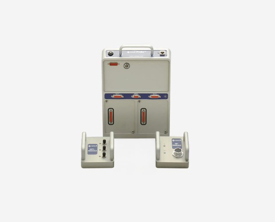
Road investigations often cover thin asphalt layers and extend to deep road embankment constructions. With Guideline Geo’s ProEx GPRsystem, several antenna frequencies (from low to high, up to eight antennas) can be measured simultaneously, saving time and cost. The system is robust and has a number of accessories suitable for road measurements, including the convenient RoadCart upon which three different shielded antennas can be mounted.
If your main applications are estimating thicker asphalt layers, assessing the full road embankment, and understanding the geology beneath the road structure, Guideline Geo’s GX system (with antennas from 80 to 750 MHz) may be more suitable. This is the easiest-to-use system, especially with its WiFi option, making many cables unnecessary.