Groundwater Prospection with Geophysics
Finding and mapping groundwater has been a constant necessity almost since the emergence of humanity itself; however, as demands upon this precious resource have increased, the search has had to widen both geographically and technologically.
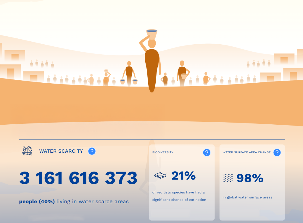
At present, over 3.1 billion people live in water scarce areas; this number increases by 50% if you include regions which experience water scarcity in at least one month per year that’s almost half the global population. Obviously, the challenge for those charged with undertaking groundwater surveys is not just limited to locating water but will often include determining accessibility, longevity, quality and security of an aquifer (the groundwater storage).
Groundwater prospection and mapping is the initial process of locating potential underground water resources, and the next step of mapping the extent and nature of an aquifer. This can be achieved through a combination of methods including desktop study, on-site geological reconnaissance, hydrogeophysical survey, and intrusive testing such as drilling.
Drilling a borehole can be very expensive and there is no guarantee of finding water at any location just by drilling deeper. As geological conditions can vary, even within short distances, a borehole will give very detailed information of the geological layers immediately beneath the drilling site but the conditions just tens of meters away may be very different. A more comprehensive investigation technique is most often needed to gain a better picture of the subsurface conditions.
Geophysical Methods for Finding Groundwater
Guideline Geo´s wide range of geophysical investigation techniques can solve most of the common questions regarding groundwater prospection and mapping. They will provide a non-destructive and cost-efficient way of gaining a better understanding of the ground conditions, supplying better data coverage than is normally achieved with traditional, discrete, point-by-point geotechnical investigations and sampling, such as drilling or digging.
For groundwater applications in general, it is necessary to use a physical property that can distinguish water from surrounding geologies, regardless of whether the water is found in unconsolidated materials (e.g. gravel, sand or silt), in rock fractures or in water-bearing permeable rock. It should also gain information about the geological structures and layers.
As some aquifers can be found very deep, the geophysical method should preferably be able to ‘reach’ depths of 200 – 300 meters, maybe even deeper.

Example of Groundwater Investigations
Typically, groundwater has a low electrical resistivity and thus most materials in which water is present will experience a change in resistivity from its original value. The more saturated with water a material is, the more its resistivity will change.
All ABEM resistivity equipment is also capable of recording the chargeability of the ground (how quickly it charges up and subsequently discharges with the application and removal of current) using time domain induced polarisation methods. This additional dataset can be very useful in the interpretation of groundwater as it helps to differentiate between clay and fresh water, for example, which a have very similar range of resistivity values.
Electrical Resistivity for Groundwater Mapping
In this example, an Electrical resistivity investigation was carried out to map the groundwater surface. The measurements were undertaken to provide an ERT (Electrical Resistivity Tomography) dataset. The differences in resistivity clearly show the groundwater aquifer as a low resistivity zone between high resistivity dry top–soils and an undulating bedrock at 10 to 35 meters below ground.

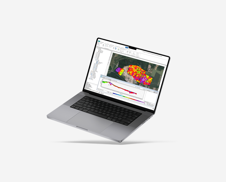
Using Transient electromagnetics (TEM) to Search for Deep Aquifers
In this example, a TEM (Transient Electromagnetic) investigation was undertaken in an arid region where there was potential for the aquifer to be quite deep – hundreds of meters below the surface. A large loop and high current was used to allow for significant penetration depth from the TEM system.
It was possible to identify three main layers: a low resistivity top layer of clays and silt, underlain by the local bedrock with relatively high resistivity but which gave way to higher conductivity zone once within the water table.

What method and technique to use?
Whilst there are many factors involved in deciding upon the best solution for a given project, these are some of the key considerations:
- If you have need of ground investigation comprising more than groundwater prospection and mapping, resistivity is a more versatile method, compared to TEM. Electrical resistivity can be used for, among other tasks, geological mapping, stratigraphic studies, mineral prospection, contaminant mapping and monitoring, and archaeological applications.
- TEM is unsuitable in urban areas due to sources of electromagnetic disturbance.
- TEM is suitable for deep investigations (>500 m) where resistivity methods might be limited by access, equipment power or general survey practicalities.
- Electrical resistivity requires galvanic contact via electrodes of some description which can be both hard and time consuming in environments with bare rock or asphalt etc.
- TEM or VES may be sufficient for broad prospection but ERT methods are best for more detailed results.
- TEM is not well suited to differentiating between highly resistive materials; the method responds better to conductive bodies.
- 1D methods (VES, TEM, VSP) are not well suited to identifying confined features like fracture zones and intrusions compared to 2D methods which offer lateral detail.
Combining Methods for Prospecting Groundwater
It is often beneficial to combine different geophysical methods to get the best resulting picture of the groundwater condition. For instance:
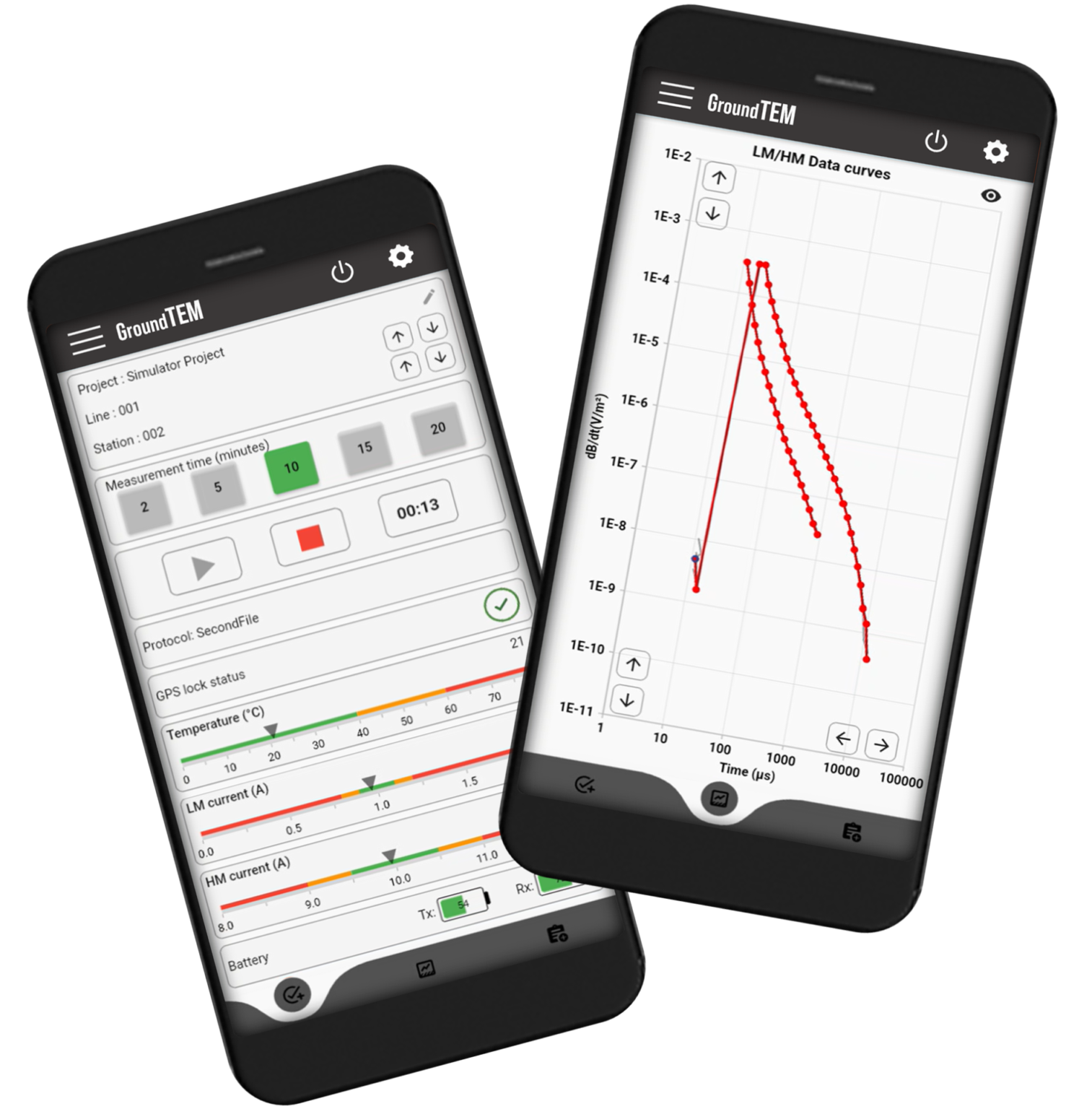
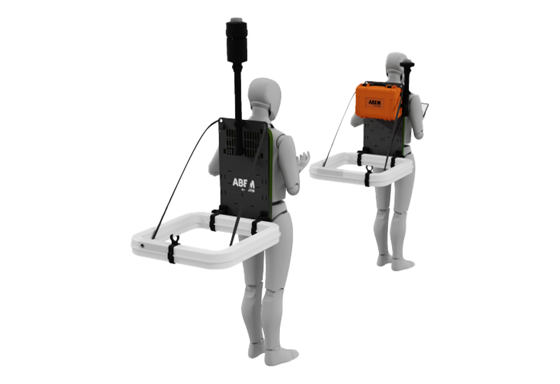
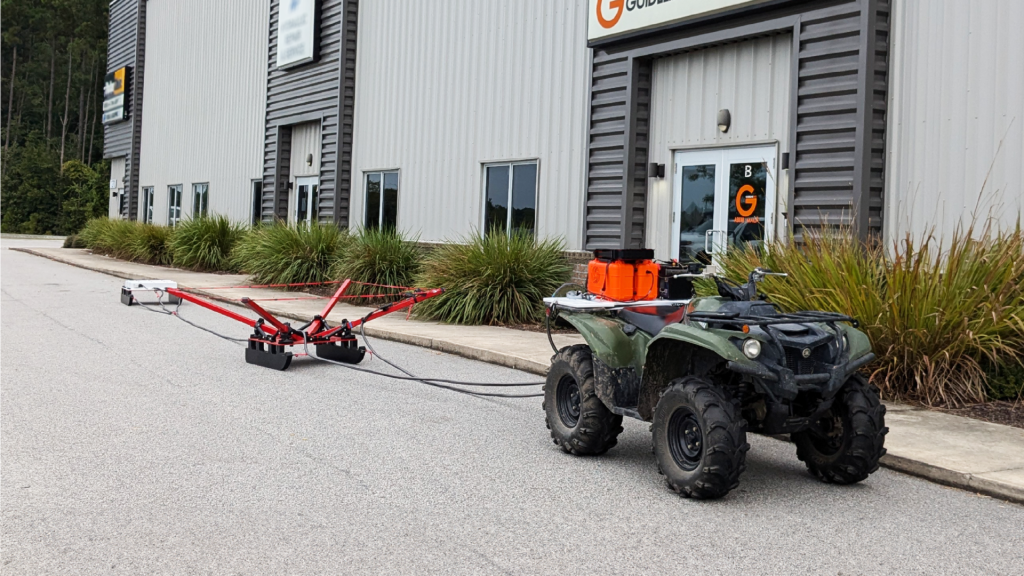
- VES/TEM and Resistivity: A broad-area sweep using 1D measurements – conducted either via traditional VES or a mobile TEM system like the ABEM GroundTEM Trek or Ralli – can serve as an essential first step. This reconnaissance phase allows for efficient scanning of large terrains to detect the most promising hydrogeological indicators and anomalies. Once these ‘hotspots’ are identified, high-resolution ERT investigations can be strategically deployed to provide a detailed characterization of the aquifer’s depth, thickness, and structural complexity, ensuring that drilling targets are selected with the highest possible confidence.
- Resistivity and TEM: It may also be beneficial to supplement ERT with a static TEM-system, like the ABEM WalkTEM 2, for deeper soundings (>500m) in areas where investigation depth needs to be greater than what can be achieved with ERT.
- GeoTech and GeoPhys: For the best possible description of the groundwater resources a combination of both geophysical and invasive physical investigations (i.e. drilling) is essential.
- Add GPR before drilling: In some environments it may be beneficial to carry out focused GPR surveys ahead of the invasive phase of works to avoid potential utility strikes.
Other Geophysical Methods for mapping Groundwater
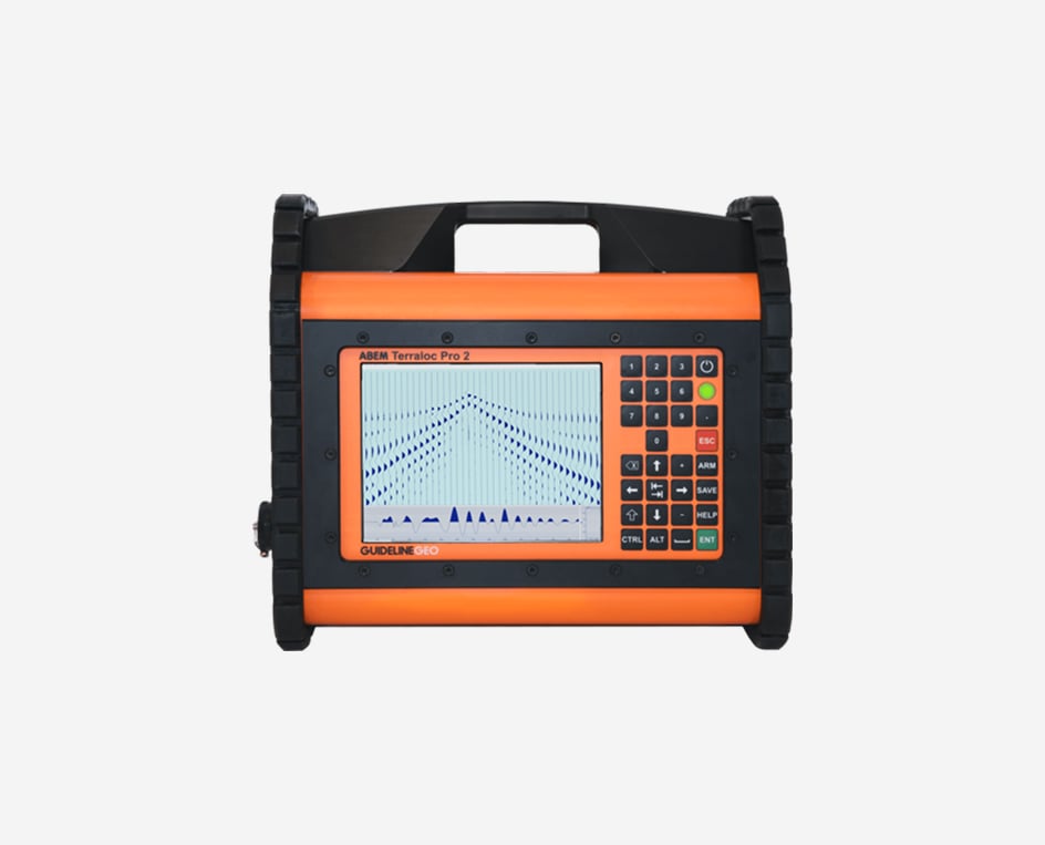
Guideline Geo also provide MALÅ GPR solutions and ABEM seismic equipment, which can also be beneficial for groundwater prospection and mapping.
Ground Penetrating Radar (GPR)
GPR (Ground Penetrating Radar) can be used to map the bedrock topography (in other words groundwater reservoir capabilities), the extent of protective clay layers, the thickness of friction soils etc. In some cases GPR can be used to map the groundwater table, but this is limited to coarse grained soils where a more distinct boundary tends to form.
Seismic Methods
Seismics are most commonly used for measuring depth to bedrock (reservoir volume) or mapping of geological structures. Depending on the aquifer type, in some situations it can be easy to detect the groundwater table using seismics as the groundwater affects the transmission velocity of seismic energy. However, depending upon porosity and water saturation it can be hard to see a large enough contrast with the surrounding geology to be able to tell definitively whether water is present.