Client
Structor Geoteknik Stockholm AB is a small consultant company in Stockholm, Sweden, who work with investigations and planning for geotechnical and geohydrological projects. They have a long experience of geotechnical investigations and use a number of different field investigation techniques to solve the underground conditions to understand the subsurface and suggest the most appropriate way of construction.
Challenge
When planning a new residence area, with roads, utilities and
houses, the knowledge of the underground conditions are essential
prior to the construction, above or below ground surface. To map the
depth to bedrock in an efficient way and get the best possible coverage
of data, GPR measurements together with geotechnical drilling
was chosen as the investigation technique.
The GPR investigations were made stepwise, with a first interpretation
without any other input data, to give a quick overview of the area.
And then the GPR interpretation was up-dated as more geotechnical
information was gained from the drillings.
Solution
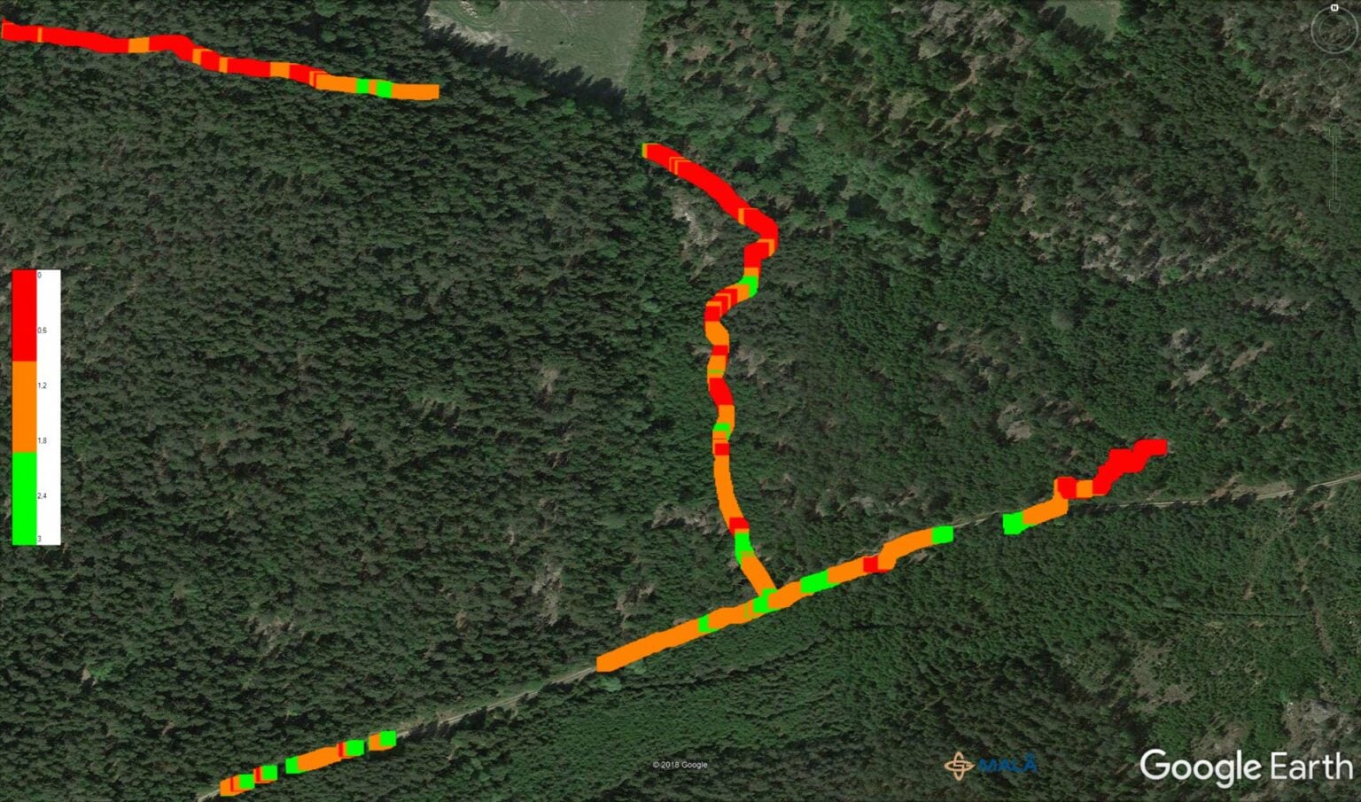
The bedrock in the area was estimated to be rather shallow or at a
maximum depth of 10 meters. So, the measurements were made
with the MALÅ GX160 system, giving approx. 15 meters measurement
depth in non-conductive conditions. The GX antenna was used
together with a pulling kit for easy work in forested terrain. The measurements
were done with a 3 cm trace interval and a time window of 350
ns. Data acquisition was made with the GX controller, with support of
the internal GPS. The investigations comprised approximately 2900 meters and
were carried out during one field day.
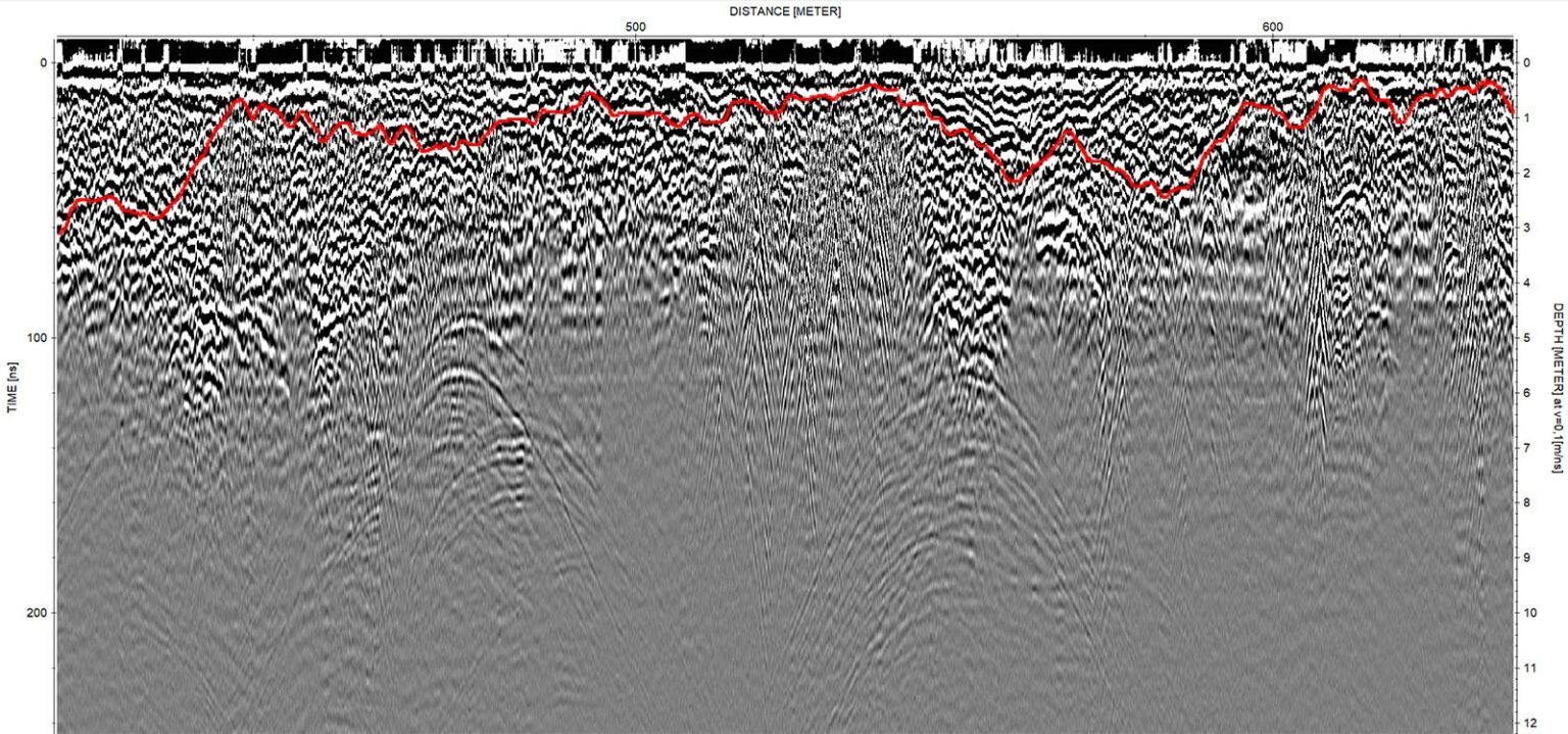
Result and conclusion
The GPR investigation, together with the geotechnical drillings,
could locate and map the bedrock level in large parts of the investigated
area. The results show a mostly shallow, but rather undulating
bedrock topography overlain by in parts clayey till, indicated in
the radar data by rather bad depth penetration and plenty of air
reflections. The MALÅ GX160 system from Guideline Geo has
been used successfully to map the bedrock level together with
geotechnical drilling. The measurements were done efficiently,
and results presented in a user-friendly way.

Acknowledgement
We would like to thank Structor Geoteknik Stockholm AB (www.structor.se/bolag/structor-geoteknik-stockholm-ab/) for sharing this case.