
Description
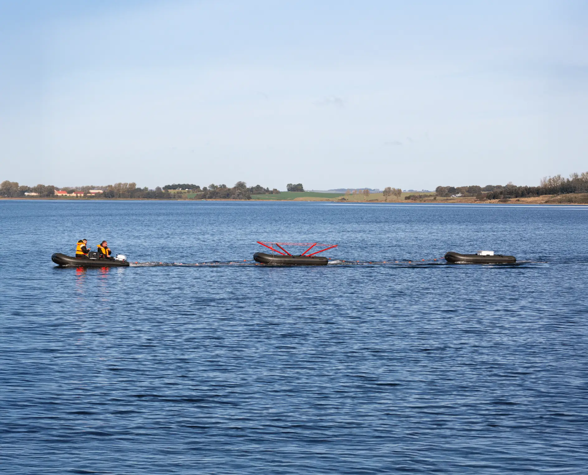
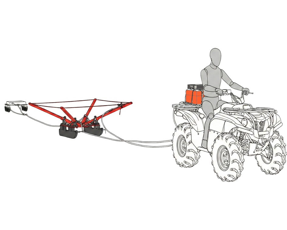
The GroundTEM Ralli represents the ultimate solution for rapid, high-resolution subsurface mapping. It’s a part of the ABEM GroundTEM instrument platform. Designed for efficiency, this cutting-edge system, based on technology from our expert partners at TEMcompany, delivers precise groundwater and geological data down to 180 m. With the Ralli Floatation Kit, the benefits of TEM survey are no longer limited to being on land, with data collection made possible over fresh and shallow brackish water.
Application areas
Groundwater
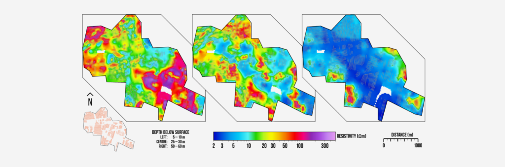
A high sensitivity to conductive materials makes TEM extremely useful in groundwater studies, for example differentiating between fresh, brackish and saline deposits, monitoring drawdown and recharge of an aquifer, or simply estimating its extents by building up profiles or grids of soundings.
Environmental
TEM provides a rapid means of surveying for a range of environmental applications from identifying potentially hazardous clay units within a geological sequence, to mapping and monitoring dynamic features such as permafrost thickness or pollution plumes.
Features
Adaptable Design

Easily configure the system with different sizes of transmitter loops/coils to suit specific survey requirements and field conditions.
Comprehensive Coverage
Conduct surveys along lines or in full 3D, covering areas from a few hectares to entire landscapes with depths ranging from a meter to 200 m.
Superior Data Quality
Advanced electronics and robust design ensure reliable and accurate measurements, even in challenging field conditions.
High Efficiency
Achieve driving speeds up to 20 km/h, making large-scale surveys faster and more efficient.
Transforming survey for groundwater and environmental studies
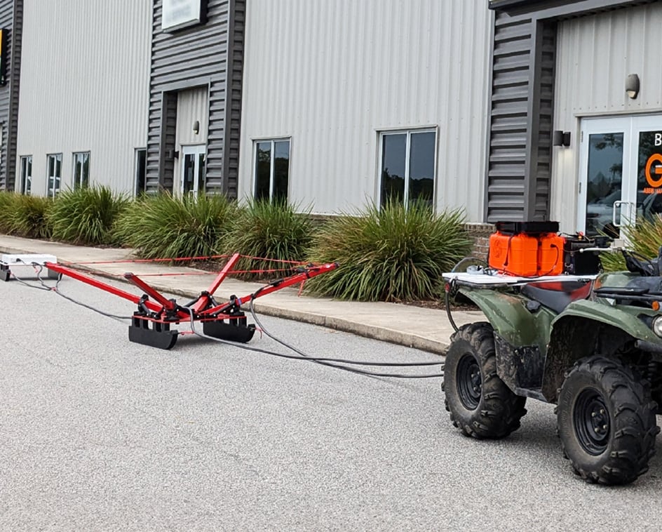
Towed by a quad bike or deployed with the Floatation Kit for waterborne operations, the GroundTEM Ralli efficiently surveys anything from a single profile to an entire landscape, providing detailed subsurface images. The system’s transmitter configuration is adaptable, allowing a choice of compact footprint or deep survey with data provided from just a metre below the surface down to 180 m. The relatively compact nature of the hardware makes shipping the system and taking it to the field particularly easy, especially for the volume of data it can return in even a short field campaign. This versatility makes the Ralli an invaluable tool for various applications such as mapping recharge pathways, helping to site wells more reliably, or studying the impact of saline intrusion.

Frequently Asked Questions (FAQ) about the GroundTEM Ralli
How deep can a GroundTEM Ralli penetrate?
This depends upon the transmitter (Tx) configuration and, especially, the geological conditions. In general, the GroundTEM Ralli is suitable for targets in the top 150 – 180 m. The 2 × 2 m single-turn Tx should achieve a maximum depth of 100 m; the 3 × 3 m single-turn Tx should achieve 100-130m maximum depth; and the 3 × 3 m three-turn Tx should achieve 150 – 180 m maximum depth.
Are the internal and external batteries hot swappable (during operation)?
No. To swap batteries, switch the instrument off first, disconnect the Tx cabling, change the batteries over, then restart following the Power-on Procedure.
Does the GroundTEM Ralli have onboard processing, like the WalkTEM 2 RX Advanced?
No not yet! Real-time processing (inversion) is an upcoming feature for the GroundTEM Ralli.
Can the GroundTEM Ralli Tx be powered from the tow vehicle 12V supply?
No, this is not advisable – the supplied voltage may not be as stable or as “clean” as the power from the Li-ion battery. The same is true for generators, they may also provide sources of coupling.
Selected Technical Specification
General
| GroundTEM Ralli Software | Navigation, data collection, and visualization (cross-platform format) |
| Power | 14.4 V (Rx) 12 V (Tx) |
| Speed | Up to 20 km/h |
| Environment | IP65, -20 to +50 °C |
Transmitter
| Output current | Dual-moment 3 A / 30 A |
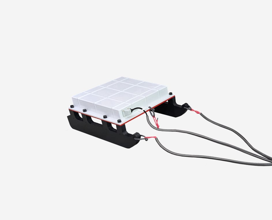
| Tx cable options | 2 × 2 m loop, 1 turn 3 × 3 m loop, 1 turn 3 × 3 m coil, 3 turns |
Receiver
| Channels | 1 |
| Receiver Coil | Rigid multi-turn 20 m² effective area |
| GNSS | Onboard |
| First Gate | Centred @ 4 µs (low moment) |
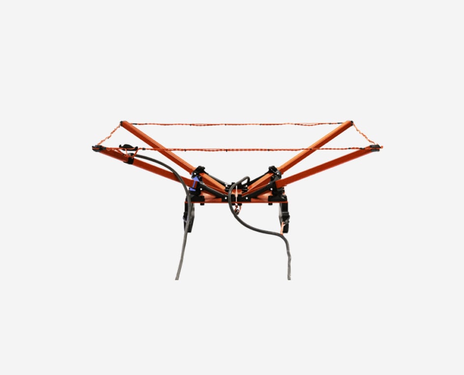
Schematic layout
The different Tx configurations define the system capabilities: 2 × 2 × 1 is a compact loop providing good depth (maximum ~100 m) but with a reduced footprint for easier deployment; 3 × 3 × 1 is the standard loop for regular sounding depth (maximum ~130 m); 3 × 3 × 3 is a multi-turn coil for deeper surveys (~180 m).
