Assessing Concrete Slab Integrity with MALÅ Ground Explorer
Summary: A freshwater storage reservoir serving large towns in Northern Queensland, Australia, reported washout of sand and no-fines concrete aggregate debris were found exiting the drains under the large tank. A geophysical investigation used a MALÅ Ground Explorer (GX) 750 MHz system, adapted for underwater operation, to identify potential subsurface voids within and beneath sections of the concrete floor. The survey found anomalies that could represent potential zones of voiding or reduced structural integrity.
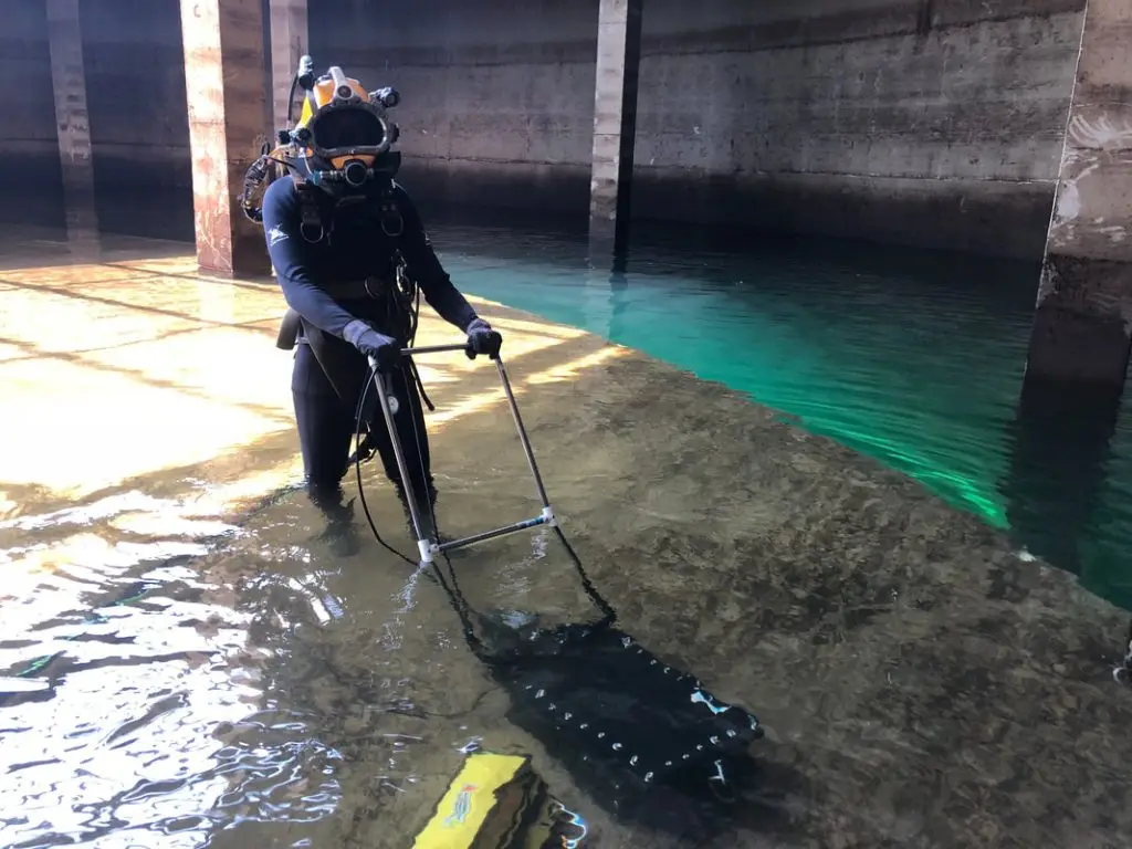
Survey setup:Divers moved the enclosed GPR instrument across the underwater floor slab. A waterproof ethernet cable connected the antenna enclosure to the GX Controller at the surface.
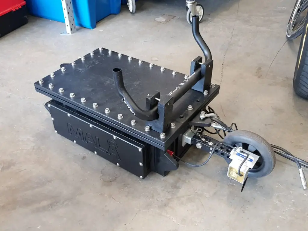
Custom built 15mm thick HDPE casing to house a 750MHz HDR GPR antenna. A magnetic distance encoder triggers data.
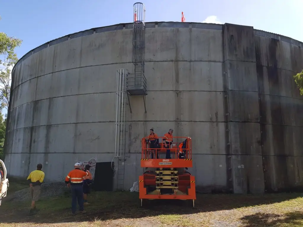
Freshwater storage tank under investigation using the MALÅ Ground Explorer GPR
Investigating Potential Voids Beneath a Submerged Concrete Structure
The reservoir comprises two tanks, with a larger tank built around a smaller one. The smaller tank is approximately 25 metres in diameter, and the larger tank is approximately 37 metres in diameter. The concrete floor slabs in both tanks were approximately 150–200 mm thick, with one layer of steel reinforcing. At the time of the investigation, the water coverage above the floors was approximately 5 metres.
The geophysical investigation aimed to identify potential subsurface voids within and beneath a section of concrete floor.
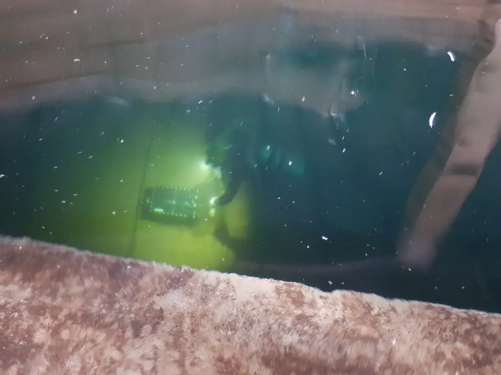
Diver 5m under water collecting GPR data within the large tank.
Adapting GPR for Underwater Operation
The survey used a MALÅ GroundExplorer 750 MHz system. Its antenna was fitted inside a custom waterproof enclosure that was tested to a depth pressure of 5 metres.
The enclosure included a custom magnetic distance encoder wheel to record horizontal chainage and trigger GPR data collection. A 25-metre waterproof ethernet cable ran from the enclosure to the GX-controller at the surface.
Survey access was through the reservoir roof. Divers manually pushed the enclosed instrument along the underwater floor slab, while personnel were standing on the concrete roof of the smaller tank, monitoring the incoming data.
Survey Results and Findings
The survey achieved near-complete data collection across the proposed grids in both tanks, using profile spacings of 25 cm and 50 cm. Reported depth penetration was approximately 55 cm.
Small Tank – GPR profiles displayed within a plan view site map. Coloured interpretation markers depict locations where anomalies were detected.
Small Tank – 2D cross section of processed data with interpretation markers inserted for areas of interest.
Anomalies were identified in data from both tanks. Consistent features across neighbouring profiles included anomalies that could relate to:
The concrete slab thickness, at approximately 180 mm depth
One layer of steel reinforcing
Potential pipes or drains
Surface or very near-surface features
Large Tank – GPR profiles displayed within a plan view site map. Coloured interpretation markers depict locations where anomalies were detected.
Large Tank – 2D cross section of processed data with interpretation markers inserted for areas of interest.
Some of the anomalies could represent potential zones of voiding or reduced structural integrity.
Conclusions
The investigation collected near-complete GPR data across the proposed survey grids in both submerged reservoir tanks, despite approximately 5 metres of water coverage. The water proofed MALÅ GroundExplorer 750 MHz system achieved approximately 550 mm of reported depth penetration.
The survey identified anomalies that could indicate potential zones of voiding or reduced structural integrity, alongside features that could relate to the concrete slab, steel reinforcing, pipes or drains, and surface or near-surface features. The case study demonstrates the use of a specially adapted GPR system to investigate submerged concrete floors in a freshwater reservoir.