
TerraLog Services is a geophysical exploration company specializing in mineral exploration for coal, iron, nickel, gold, and other natural resources. The company provides comprehensive exploration services, covering the entire workflow from field surveys and data acquisition to data processing, geological interpretation, and modelling. TerraLog Services operates primarily in Indonesia and is a subsidiary of PT. RecsaLog Geoprima.
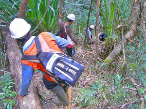
The study presented here, including fieldwork, data processing, and initial reporting, was carried out before 2012. The photograph above is not from the original survey but illustrates a similar field operation using MALÅ Rough Terrain Antennas for the exploration of nickel-bearing laterite deposits.
Nickel-bearing laterites are among the world’s most important sources of nickel, but they are also some of the most challenging mineral deposits to evaluate. Formed through intense tropical weathering, laterite deposits often exhibit highly variable geology over relatively short distances.
Traditional exploration methods relying solely on borehole drilling can be both costly and time-consuming, particularly in remote areas with rough terrain and dense vegetation. Because boreholes provide information only at discrete locations, accurately characterizing the extent and internal variability of laterite deposits often requires a large number of drill holes.
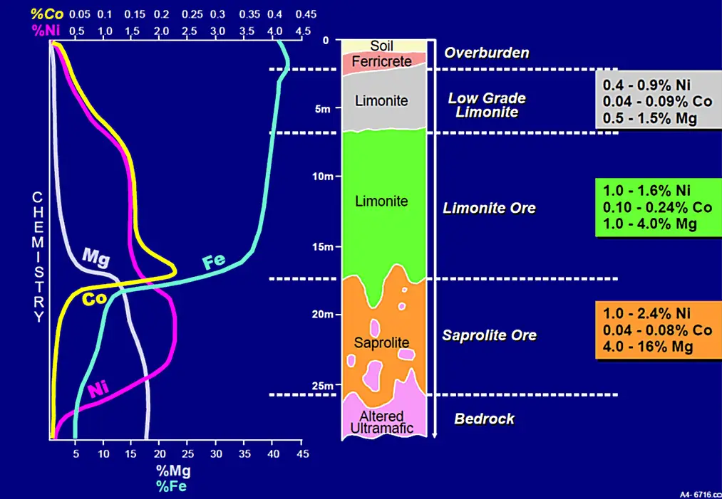
To improve resource delineation and support more informed mine planning, TerraLog Services sought a geophysical method capable of rapidly mapping subsurface geological variations between boreholes.
TerraLog Services integrated Ground Penetrating Radar (GPR) surveys into their exploration workflow by using a MALÅ ProEx solution and the MALÅ Rough Terrain Antennas (RTA). The GPR data collected was used alongside a few strategically placed boreholes to obtain a more complete understanding of the geological conditions within laterite deposits.
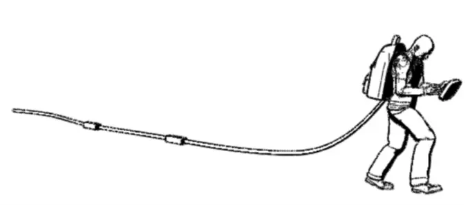
The MALÅ Rough Terrain antennas are low frequency GPR solutions. The antennas are built in a flexible tubular casing, suitable for one-man surveys through rough terrain and dense vegetation.
The combination of Ground Penetrating Radar and targeted drilling provided TerraLog Services with a more efficient approach to laterite exploration. Continuous GPR profiles complemented borehole information, improving the understanding of subsurface geology while supporting more effective exploration planning.
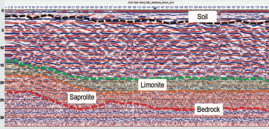
Using the MALÅ ProEx system together with the MALÅ Rough Terrain Antenna, TerraLog Services successfully mapped geological conditions within nickel-bearing laterite deposits and gained valuable information for prioritizing further investigations. The integrated workflow contributed to improved confidence in resource evaluation while helping optimize exploration efforts and mine planning.


