UAV- or drone-based GPR was successfully used to map ice thickness.

Want to know more?

Get in touch with us for expert help.

Summary

UAV- or drone-based GPR was successfully used to map the ice thickness on a large lake prior to a car racing event in Sweden. The GPR investigation enabled a fast and safe check of the ice conditions before allowing both people and cars onto the ice.

Project

Method: Ground penetrating radar (GPR)
Solution: GeoDrone 600 and MALÅ Controller App
Software for processing and interpretation: ReflexW and MALÅ Vision 

A cold and crisp day for the ice racing event

Challenge

A car racing event on ice is highly dependent on the ice thickness.  Not enough ice-thickness, no racing. It is as simple as that. And since weather conditions tend to change, the ice needs to be monitored on several occasions before the race. At this particular event, the total length of the racetrack was more than 8,000 meters, divided over two speed tracks, a racetrack, and a runway for airplanes. Using conventional measuring techniques, such as ice coring, would have been very time-consuming.

Solution

To be able to cover long stretches of ice in a safe and efficient way, a drone-based GPR solution was chosen. This enabled measurements to be taken early in the season and on unknown parts of the lake, without risk for personnel or material. The ice was estimated to be less than 1 meter in thickness, which is suitable for the MALÅ GeoDrone 600 antenna.

The MALÅ GeoDrone 600 antenna was mounted on a DJI Matrice drone, enabling the external TTF (True Terrain Following) equipment to have a clear line of sight downward. This allowed automatic height correction to be used throughout the investigation, keeping the drone at a maximum height of 1 meter.

To achieve the best possible data quality, MALÅ Motion Trig was used to trigger the data collection. This enabled equidistant data, with a fixed trace interval of 5 cm, without using an encoder or wheel.


The ice thickness measurements were carried out with MALÅ GeoDrone 600 mounted on a DJI Matrice drone
Paths of the drone
A radargram where no correction has been made for the flight height. The ice surface is marked in green and the ice thickness in blue
Radargram corrected for flight height and the ice thickness is shown in blue

Results and Conclusions

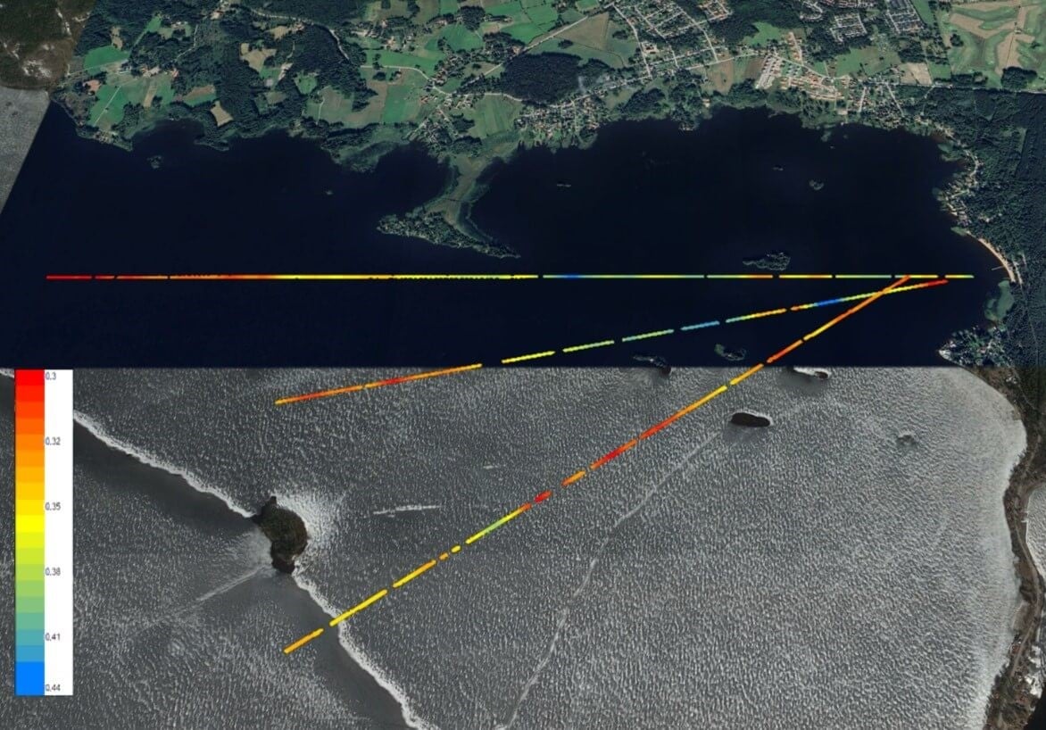
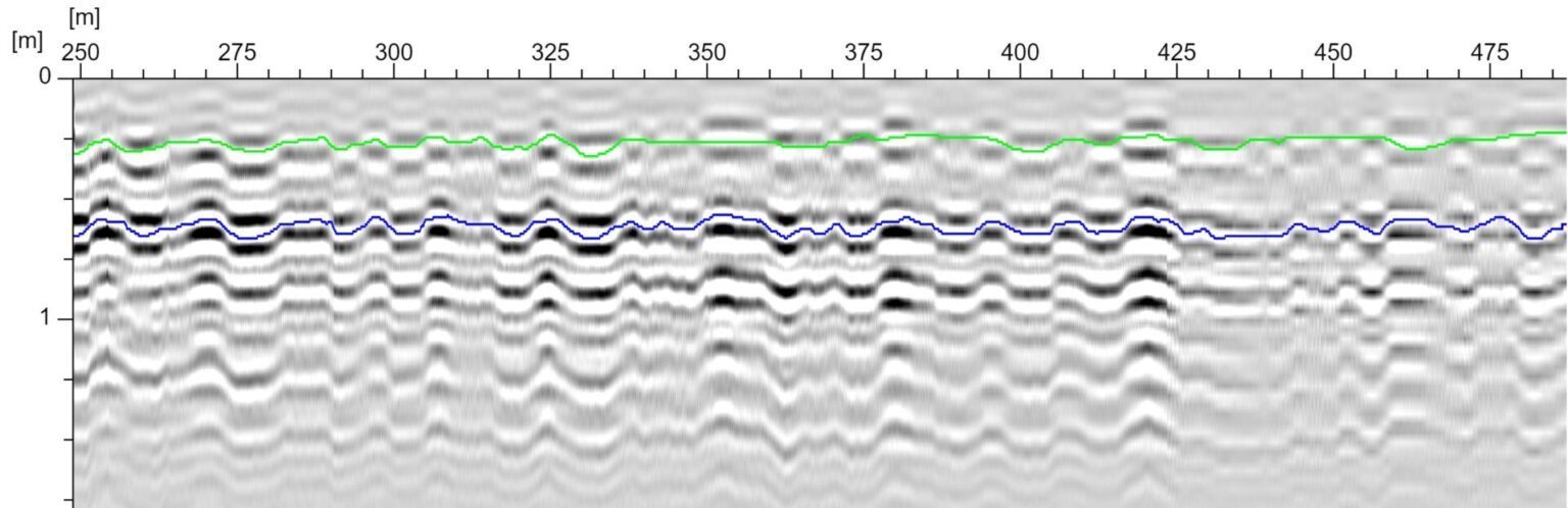
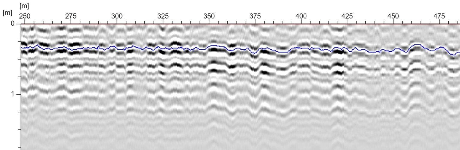
The MALÅ GeoDrone 600 solution delivered highly detailed data on the ice thickness across the entire investigation area.

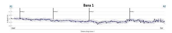
The thickness of the ice was fairly uniform throughout the investigation areas and varied between 30 and 40 cm. This was considered safe enough to carry out the ice race event.

GPR data from the entire racing track were compared and correlated with ice core samples before the delivery of results

Acknowledgement

We would like to thank the department’s Sweco Sweden Drones and Geotechnics at Sweco AB (www.sweco.se) and Landracing (www.landracing.se) for sharing the information above.  

Sweco AB is a leading European engineering and architecture consultancy, specializing in planning and designing sustainable communities and cities for the future. With approximately 22,000 architects, engineers, and other specialists, Sweco collaborates with clients to develop solutions that address the challenges of urbanization, digitalization, and sustainability. The company offers a broad range of services in areas such as buildings and urban development, water, energy and industry, transport infrastructure, and architecture.

Landracing.se is a private association organizing a yearly recurrent speed racing event in Sandviken, Sweden, for motorbikes and cars, competing on lake ice.  

Related Methods

Related Products

Newsletter

Sign up for Guideline Geo’s newsletter and be the first to know.