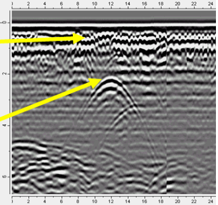
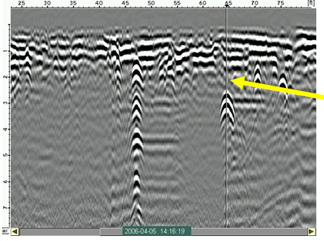
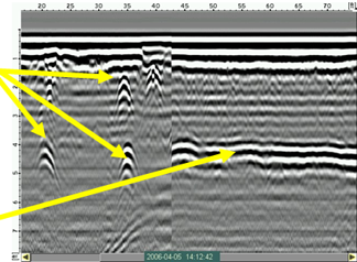
Underground utility locating data examples

Want to know more?

Get in touch with us for expert help.
Back up cursor centered over detected utility from backing up GPR system perpendicular to pipe. Target marked at midpoint of transducer on the ground surface.
Multiple utility targets GPR transducer moved perpendicular to pipe (the three arrows) Pipe reflection from traversing GPR transducer along the pipe (to the right)
Concrete slab cover with rebar targets (small hyperbolas) (top, left) 6″ plastic water line (middle)
More reading

The-investigation-team-that-did-the-Marine-ert-survey

Nearshore Sand Deposit Mapping with Electrical Resistivity Tomography (ERT)

In a recent Marine ERT survey the ABEM Terrameter LS2 successfully mapped nearshore sand deposits…

How ERT and TEM Surveys Solved a Water Crisis on Remote Island: From 10 to 100 Tons per Day

From 10 to 100 tons of groundwater yield per day: …

ERT-Based Subsoil Assessment to Support Reliable Foundation Design

Supporting safe foundation design using Electrical Resistivity Tomography (ERT)…

Newsletter

Sign up for Guideline Geo’s newsletter and be the first to know.